


Great Lakes 3-D Nautical Wood Chart 24.5"x31"
$342.00
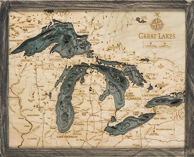
Beautiful map of the Great Lakes. A 3-D nautical wood map of the Great Lakes region in a grey farm wood frame. Size 24.5" x 31"
The Great Lakes are a collection of freshwater lakes which connect to the Atlantic Ocean through the Saint Lawrence Seaway and the Great Lakes Waterway. Consisting of Lakes Superior, Michigan, Huron, Erie, and Ontario, they form the largest group of freshwater lakes on Earth, containing 21% of the world's surface fresh water. When you’re searching for unique gift ideas for the aquatic lover in your life, look no further than a Great Lakes nautical map.
- Grey frame
- Made of High-Grade Birch
- Solid wood frame made to fit
- Laser-cut depth
- Engraved names and locations
- Acrylic glass protection
- Ready to hang